
3 The Dorset Historic Environment Record (HER) today
Dorset Council maintains the HER for the geographic county of Dorset which is composed of the two unitary authorities Dorset Council and Bournemouth Christchurch and Poole Council, an area of 265,275 hectares or approximately 2,653 square kilometres. Maritime archaeology is also recorded.
- 3.1 The Dorset HER in 2020
- 3.2 Achievements
- 3.3 Performance against national benchmarks
- 3.4 Current user experience
- 3.5 Volunteers
- 3.6 The HER Forum
- 3.7 Outreach and education
- 3.8 Strengths, weaknesses, opportunities, and threat analysis
3.1 The Dorset HER in 2020
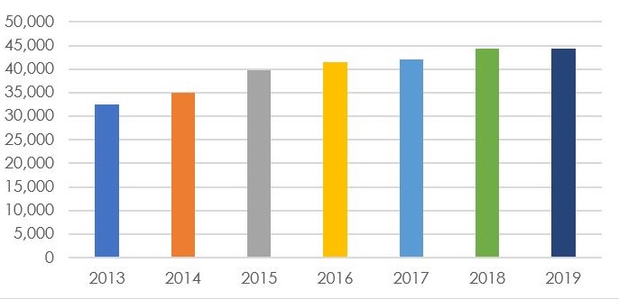
The Dorset HER database contains more than 44,000 monument records with information about remains from the prehistoric period to the present day. Information on nationally-designated (scheduled monuments, listed buildings, protected wrecks, and registered parks and gardens), locally-designated, and undesignated heritage assets is recorded. As well as information on archaeological finds and features and historic buildings (all known as ‘Monuments’), episodes of fieldwork and recording such as excavation and historic building survey (known as ‘Events’), and the various sources from which information about them has been drawn (known as ‘Sources’) are recorded in the HER.
Table: Monument, Event and Source records by year from 2013 to 2019
| Year | Monument | Event | Source |
|---|---|---|---|
| 2013 | 32,478 | 6,041 | 7,717 |
| 2014 | 34,934 | 6,052 | 8,470 |
| 2015 | 39,713 | 6,128 | 8,649 |
| 2016 | 41,471 | 6,391 | 9,475 |
| 2017 | 42,078 | 6,698 | 10,172 |
| 2018 | 44,266 | 6,854 | 10,898 |
| 2019 | 44,317 | 6,918 | 11,016 |
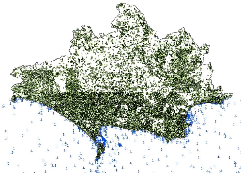
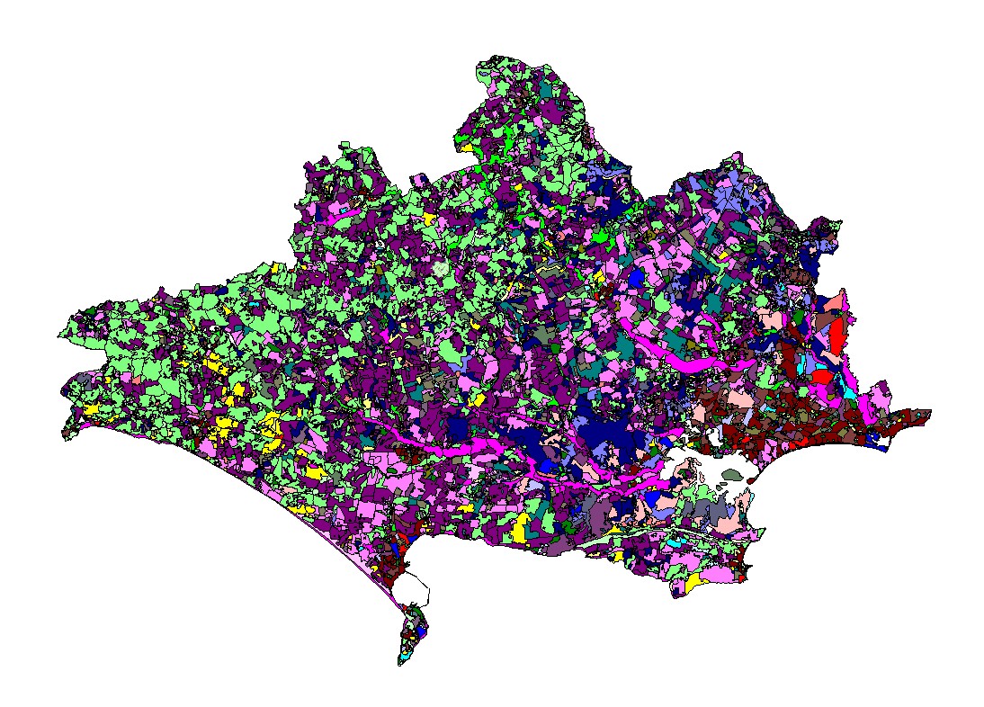
The database is linked to a Geographic Information System (GIS) with geographical depictions of all sites on the database, ranging from simple point locations to complex plots for extensive size such as ancient field systems, and supplemented by materials such as reports on work that has taken place as part of the planning process (known as ‘grey literature’) and photographs. These materials are in a mixture of digital and hard copy formats.
As well as local and national government and other agencies such as the Environment Agency and Forestry Commission, the HER provides information and advice to:
- developers and their agents
- archaeological contractors
- farmers, landowners and other land managers
- utility companies and statutory undertakers
- local communities, including community groups undertaking parish plans
- teachers, students, and researchers
- amateur archaeologists, local history and other groups interested in some aspect of the historic environment
- authors and journalists
- local residents and other interested individuals.
3.2 Achievements
Significant enhancement of the HER has been achieved through several projects initiated following earlier HER audits. Funded largely by Historic England (with contributions in kind from Dorset County Council and financial contributions from the Dorset AONB (Historic Landscape Characterisation and the South Dorset Ridgeway AIM Project) these projects include:
- Rapid Coastal Zone Assessment (RCZA) (2003) undertaken by Wessex Archaeology.
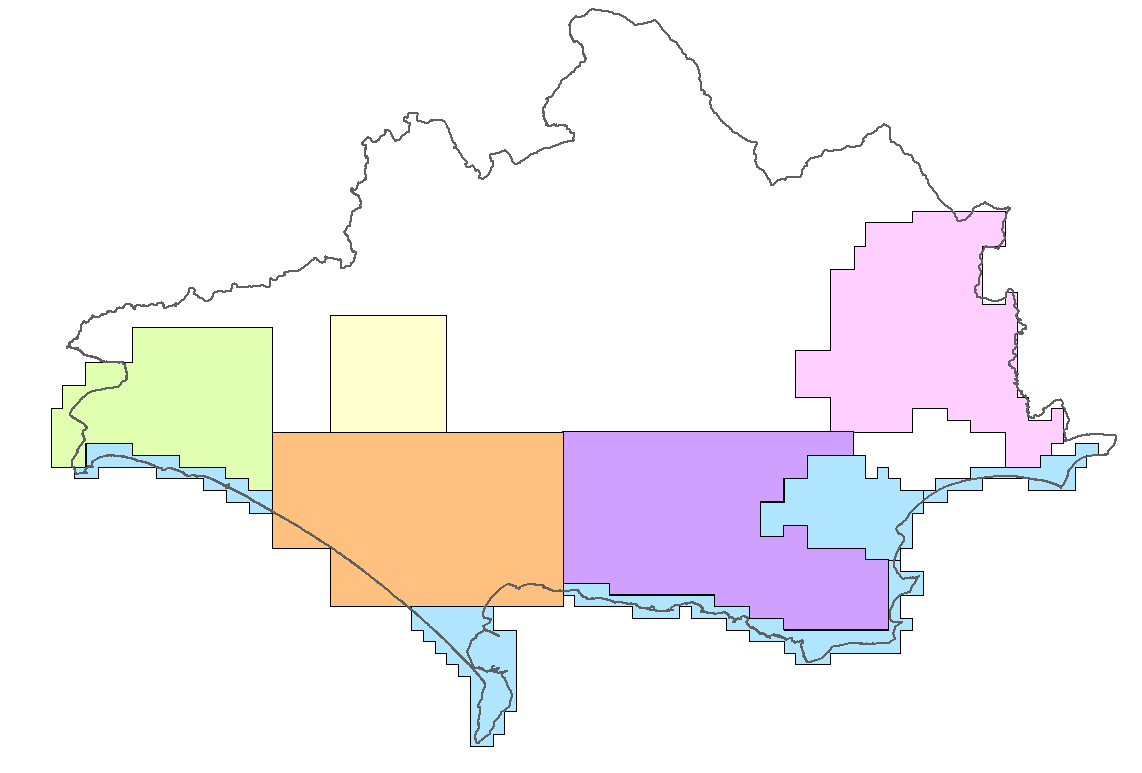
- Historic Landscape Characterisation (HLC) of the geographic county (2005). HLC is based on the notion that every aspect of the landscape has been shaped by human activity. It is a map-based technique using a Geographical Information System (GIS), and analyses the visible evidence of past human activity (chiefly agricultural) which survives in the present-day landscape. The result is a tool for understanding the processes of change, identifying what is vulnerable, and maintaining diversity and distinctiveness in the local scene.
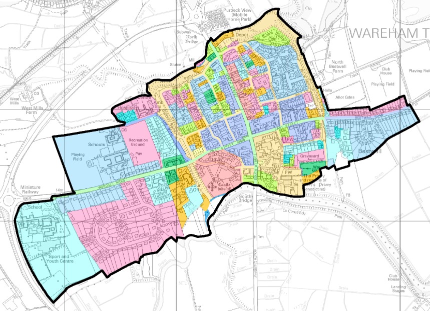
- Urban Archaeological Database (UAD) for Dorchester (2009) undertaken by a team based within the HER. Innovative in that the UAD was created directly within the HER database and not as a stand-alone database.
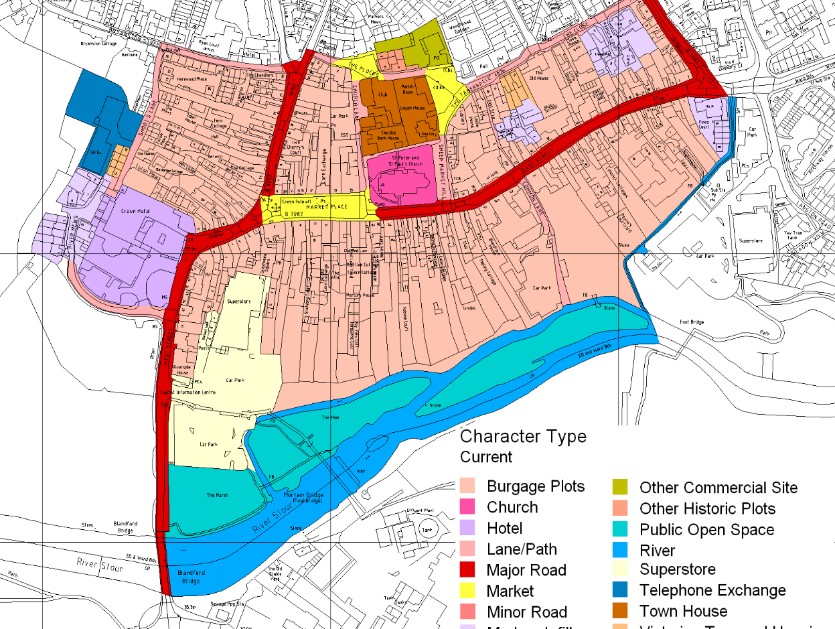
- Dorset Historic Towns Survey (2011) an Extensive Urban Survey (EUS) of 21 historic towns in Dorset undertaken by a team based within the HER. Applies the technique of characterisation used in HLC at a more fine-grained scale to urban landscapes.
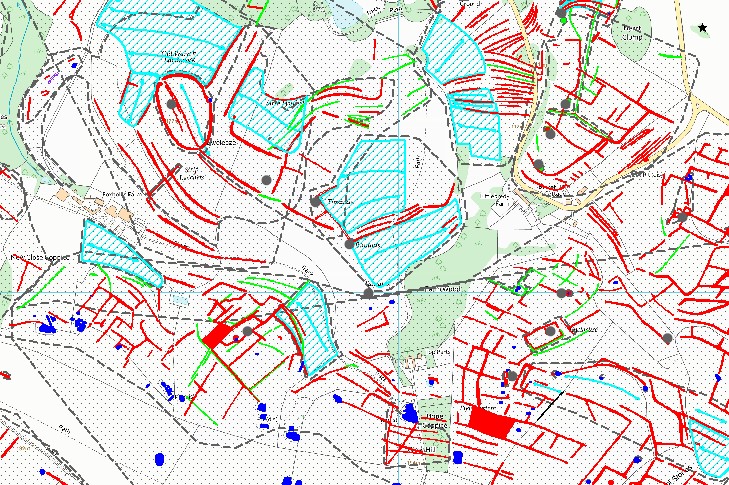
In addition, there have been several Aerial Investigation and Mapping (AIM, previously known as the National Mapping Programme or NMP) projects in Dorset. Funded largely by Historic England, these projects map archaeological features from aerial photographs and digital imagery such as LiDAR and have been carried out by a specialist team based at Cornwall Council working remotely in the HER database and include:
- South Dorset Ridgeway (2011)
- Rapid Coastal Zone Assessment (RCZA)Survey Phase One Desk-based Assessment for South-West England (South Coast Dorset) (2015) (see note below)
- Wild Purbeck Aerial Investigation and Mapping Project (2016)
- Marshwood Vale Aerial Investigation and Mapping Project (2017)
- Stour Valley Stage 1 (2019)
- Upper Frome Valley (2020)
Note: The project aimed to inform future coastal and shoreline management by providing an overview of coastal change from the Palaeolithic onwards, and assessing the degree and nature of threat to coastal historic assets and the potential and vulnerability of the resource. Carried out by the Cornwall Archaeological Unit and Bournemouth University.
In 2013 the HER undertook a pilot project which explored approaches to the recruitment and use of volunteers to carry out Buildings at Risk survey of Grade II listed buildings in Dorset. The project sought to create and test a way of using volunteers to gather consistent high-quality information that was repeatable and sustainable in the context of limited officer time and resources. Significant insight was gained, and an approach developed that combined a good volunteer experience with the most productive use of officer time, in a way that could be maintained in the long term and extended to other types of survey.
The HER continues to create records in the Selected Heritage Inventory for Natural England (SHINE)funded by Natural England, which feeds into land management schemes such as Countryside Stewardship.
In 2019-20 the HER shared an internship partly funded by the Headley Trust with the Dorset Portable Antiquities Scheme. The intern analysed data reported to the HER by metal detectorists before the advent of PAS and data already imported into the HER from the PAS database, to identify common types of error and feed into future data cleaning and import processes.
The HER is currently participating in the NRHE to HERs Project by which data is being devolved from the National Record of the Historic Environment (NRHE) to local Historic Environment Records. This is being done with a grant from Historic England.
3.3 Performance against national benchmarks
The audit of the HER carried out in 2019 showed performance against national benchmarks in general to be good. Areas where action is required were identified against HER Audit Service Outcomes which are:
Table: HER audit Service Areas and Service Outcomes
| Service area | Service outcomes |
|---|---|
| Service Area A Content and coverage | Service outcome A1: The HER is maintained as a dynamic and constantly evolving resources. Service outcome A2: The HER contains and signposts information on a full range of heritage assets of a defined geographical area within the local planning authority it serves. |
| Service Area B Data standards and security | Service outcome B1: The HER complies with relevant UK national data standards and legislation. Service outcome B2: The HER is safeguarded by adequate data back-up and security procedures. |
| Service Area C Access and engagement | Service outcome C1: The HER readily makes its information available to all. Service outcome C2: The HER actively works to engage audiences. |
| Service Area D Infrastructure and service delivery | Service outcome D1: The HER is actively managed enabling it to deliver an effective service. Service outcome D2: The HER is appropriately resourced |
Table: Summary of 2019 HER audit rating against service outcome categories used in the audit process
| Outcome | Rating |
|---|---|
| A1 | Little action is required |
| A2 | One or more actions required in this area |
| B1 | Little action is required |
| B2 | Little action is required |
| C1 | Little action is required |
| C2 | Little action is required |
| D1 | One or more actions required in this area |
| D2 | Little action is required |
3.4 Current user experience
The Historic Environment Record is based at County Hall in Dorchester, and in normal circumstances open to the public during office hours by appointment. Occasionally people use the HER on Saturday mornings, by arrangement. The HER shares an office with the local Portable Antiquities Scheme. Office opening hours and arrangements for consulting the Historic Environment Record are advertised via the Dorset Council website.
Guidance for HER users covers matters such as the purpose for which the HER is maintained, access and charging, response times and format, data protection and privacy, and information on how users can provide feedback or make a complaint.
Most HER enquiries are dealt with by email. Enquirers are encouraged to submit enquiries via an on-line enquiry form, for ease and speed of processing.
Table: HER use by year from 2013 to 2019
| Year | Commercial | Academic | CSS | Internal/council | Other non-commercial | Total |
|---|---|---|---|---|---|---|
| 2013 | 89 | 56 | 50 | 58 | 76 | 329 |
| 2014 | 140 | 44 | 20 | 45 | 80 | 329 |
| 2015 | 102 | 30 | 58 | 47 | 105 | 342 |
| 2016 | 76 | 26 | 144 | 40 | 69 | 355 |
| 2017 | 92 | 39 | 265 | 39 | 58 | 493 |
| 2018 | 104 | 15 | 306 | 23 | 47 | 495 |
| 2019 | 80 | 20 | 114 | 18 | 70 | 302 |
Note about this table: categories are as used by Historic England as part of their annual survey of HERs. The CSS (Countryside Stewardship Scheme) figure includes consultations on forestry, the Hedgerow Regulations, and Environmental Impact Assessments relating to agricultural use, as well as the Environmental Land Management Scheme current at the time.
Summaries of selected HER monument records are made available online through the Heritage Gateway. They are updated at irregular intervals and link to mapping on the Dorset Explorer website. Both with the caveat that the data is not suitable for in-depth research, planning or land management purposes.
Visitors to the office have access to reference collections and photocopying facilities and can use a computer terminal. There is disabled access and the HER offices have been examined to ensure that they satisfy the terms of the Equality Act (2010).
All enquirers are asked to complete a user satisfaction survey via the website or using a paper form that can be provided on request. Few complete the form; those that do give very positive comments.
People who give information to the HER submit reports in a variety of ways, including the proverbial note on the back of an envelope. Understanding submissions and making them compatible with the HER database falls to officers and volunteers, and can be time consuming.
3.5 Volunteers
A small team of volunteers work on the HER database, usually for half a day a week each. Other volunteers drop in and out as their commitments allow, and in response to different recording projects. No more than two volunteers can work in the office at any time, and provision for field survey and remote data entry is limited by officers’ other commitments and need for technical support. Technically adept volunteers and the parish liaison officers (HELO) exhibit a keen interest in the database and have the potential to provide considerable assistance with data entry and recording in the field or through a website.
3.6 The HER Forum
The Dorset HER Forum is used to involve current and potential users and contributors in the development of the HER. People within the Forum are consulted at open meetings, most recently in 2019, and by email. The Forum brings wider knowledge and expertise from local communities and government, and the business, education and cultural sectors to the development of the HER and informs the ways we all use and benefit from the information the HER contains.
3.7 Outreach and education
The HER and its services are actively publicised through via the corporate website, posters and a leaflet. The HET organises or participates in numerous outreach activities, including:
- guided walks including Dorset Archaeological Days, organised jointly with the Dorset Archaeological Committee
- day schools (2-3 per year) including one on planning or community-based archaeology in alternate years
- an occasional series of 'Finding Dorset' events with focus on finds (with the Finds Liaison Officer, Portable Antiquities Scheme) consisting of Saturday morning workshops suitable for the general public, with more intense training sessions for HER/PAS volunteers, metal detectorists, and local museum staff and volunteers
- More focussed training for local museum staff and volunteers has been provided on the HER, PAS, the Treasure Act, human remains, and other topics.
The HER also participates in events organised by others, as invited, for example:
- local museums
- the Ancient Technology Centre
- the Dorset AONB South Dorset Ridgeway
- Stepping Into Nature projects
- the National Trust
Talks are given to local groups and societies.
The Dorset Council Metal Detecting Liaison Scheme was established in 1996 and (now alongside the Portable Antiquities Scheme) continues to provide a means of increasing awareness of the HER, as well as promoting responsible metal detecting and developing best practice for metal detecting and other forms of amateur archaeological fieldwork in the county.
Regular half-day visits (usually with Finds Liaison Officer) are made to local museums or libraries to give students and members of the public an opportunity for face-to-face discussions about finds, HER enquiries, research projects.
3.8 Strengths, weaknesses, opportunities, and threat analysis
Strengths
- Dorset’s magnificent historic environment
- quality work by key archaeologists, architects etc deserving of wider presentation
- the skills of the team and their peer networks
- a service contract with BCP provides for economies of scale and consistency of approach across the historic county
- strong in-house support from Dorset Council
- a strong core team of volunteers
- use of HBSMR ‘industry standard’ software
- an extensive mailing list
- an engaged HER Forum
- goodwill generated by current contacts
Weaknesses
- ‘legacy’ weaknesses in format and quality of data affecting older records
- lack of resources means that quality time for officers to concentrate on essential record improvement is not adequate
- lack of awareness of HER purpose and potential on the part of council colleagues; sometimes inappropriate use of HER data by them
- only a small number of volunteers can be accommodated at County Hall
- no provision for remote HER input by volunteers and others
- lack of priority and integration of HER plans into corporate developments and wider initiatives
- lack of identity/brand for HER
Opportunities
- recent (2019) Local Government Reorganisation makes it possible to achieve a consistent approach to HER use across the host authority and county wide.
- educational use of the HER can be increased to a wider audience
- the parish liaison officer scheme can be built upon to take the HER to the heart of communities across the county
- potential for increased links to existing projects, institutions and other organisations
Threats
- need to ensure that HER infrastructure is sufficiently robust to support increased demand
- incautious ‘big hit’ approach to community involvement leads to engagement without understanding
- fragile resource, requiring measured approach to encouraging physical access
The next part of the forward plan
4 This forward plan 2021-2025
Senior Archaeologist, Promotion and Liaison
Name: Claire PinderEmail: [email protected]
Tel: 01305 224921
Full contact details