
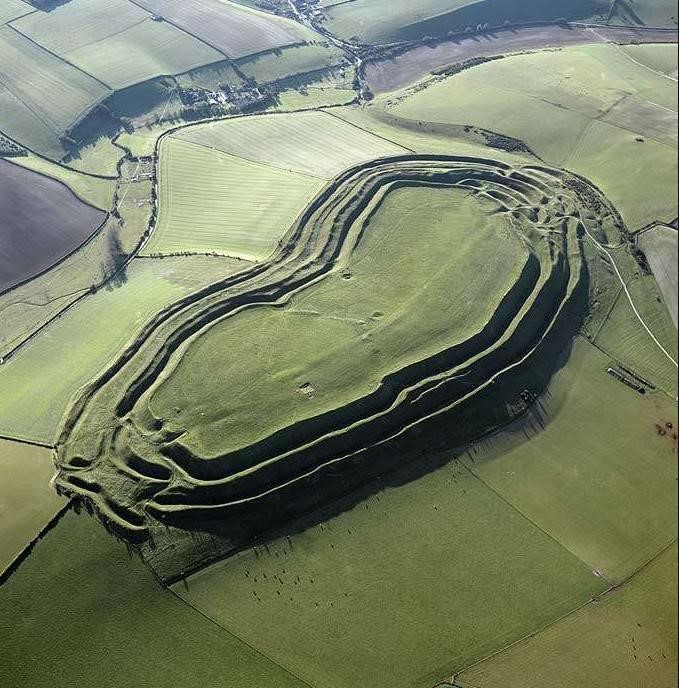
Aerial photograph of Maiden Castle © Historic England
Archaeological Investigations and Mapping (often seen abbreviated to AI&M) methods were developed by English Heritage, now Historic England, to identify, map and record archaeological features and landscapes from aerial photographs and other airborne remote-sensed data such as LiDAR.
Expert aerial photograph interpreters scrutinize these images to identify structures, earthworks and below-ground archaeological remains visible as crop or soil marks, which are then described and mapped to a consistent standard.
There have been several Archaeological Investigations and Mapping projects in Dorset. The work is done by a specialist team based at Cornwall Archaeological Unit, Cornwall Council. They work remotely in the Dorset Historic Environment Record (HER) database to enhance and create records and, when each project area is complete, their mapping is merged into the HER and a report is produced:
- South Dorset Ridgeway
- South West Rapid Coastal Zone Assessment Survey - Dorset
- Wild Purbeck
- Marshwood Vale
- Dorset Stour
- Upper Frome and Sydling Valleys
- Dorset Middle Stour
- Dorset Upper Cerne and Piddle Valleys
That is a lot of photographs! And new Dorset projects are being developed.
These projects have all been funded by Historic England (with a contribution from the Dorset National Landscape for the South Dorset Ridgeway Project) and you can see the results of these and other projects in England on Historic England's Aerial Archaeology Mapping Explorer and find out more about Archaeological Investigations and Mapping on the Historic England website.