
Across the Wessex area, rainfall for August was ‘above normal’ for the time of year at 157% Long Term Average. Rainfall in the Frome catchment was ‘notably high’ in August at 180% Long Term Average. The month started dry, with rainfall concentrated in the second half of the month. 22% of the month’s rainfall fell on 27th August. (Environment Agency Water Situation Report for the Wessex Area: August 2020).
During the afternoon of 27 August 2020, heavy rainfall fell on Dorchester and the surrounding areas. Unfortunately, the local rain gauge at County Hall failed during the event so it was not possible to derive local rainfall total / intensity with any degree of confidence.
Surface water flowed from the high points in the town via the highways towards the low points. These low points include Fordington, Evie Place, Olga Road and Weatherbury Way. The flow of water inundated the highway drainage system.
Residents reported concerns regarding:
- the maintenance of the drainage system and highway gullies
- the maintenance of the sewerage system
- bow waves from vehicles driving through flood waters
A total of eight properties experienced internal flooding as a result of the flood event, the affected locations are discussed in more detail in Section 4.3.
Table 2 Summary of properties flooded. (Based on numbers reported and brought to our attention during this investigation.)
| Location | Number of properties flooded internally | Incident Date | Main source(s) of flooding during incident |
|---|---|---|---|
| Fordington | 4 | 27/08/2020 | Surface water |
| Olga Road | 3 | 27/08/2020 | Surface water |
| Weatherbury Way | 1 | 27/08/2020 | Surface water |
NB: It should be noted that this report is based only on the information brought to the attention of DC, it does not guarantee an exact list of affected properties during this flood event.
Rainfall data
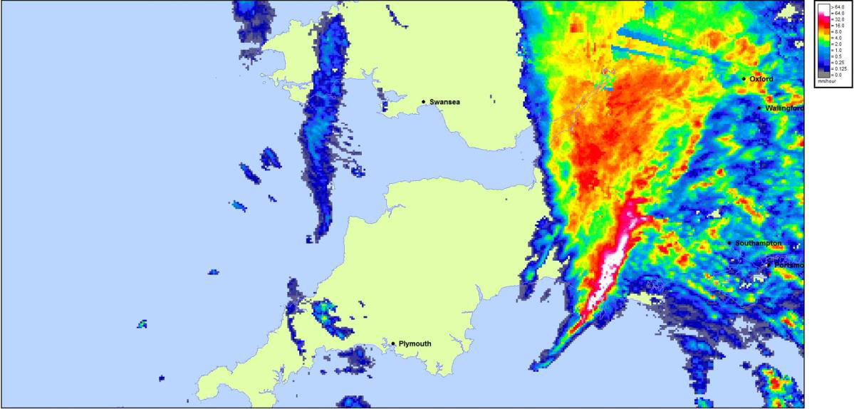
Intense rainfall was evident in Dorchester on 27th August and supported by Met Office rainfall radar data. The radar data shows that there was an intense downpour between about 3:20 and 3:35pm, with an estimated 15mm falling in 15 minutes, equating to a return period of 1 in 9 years.
Unfortunately, the local rain gauge at County Hall failed during the event so it was not possible to derive local rainfall total / intensity with any degree of confidence.
Figure 3 - HYRAD Screenshot – Rainfall 15:25 BST, 27/08/2020
Groundwater Records
The EA maintains a network of groundwater monitoring boreholes across the country, which are used to monitor and inform management of groundwater resources. During August, monitored groundwater elevations were low as a result of limited recharge occurring in Summer as a result of the low rainfall. Groundwater flooding was not experienced during the event.
Locations Affected
This section provides site specific information on the main areas of Dorchester affected by the flood event.
Fordington/High East Street
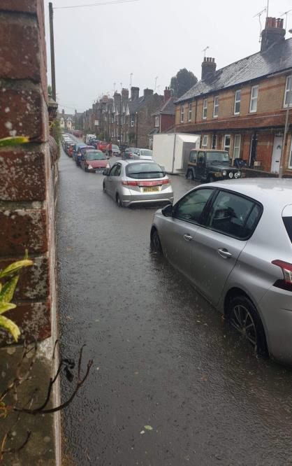
Fordington is one of the lowest lying areas in Dorchester and has a history of flooding. It flooded in July 2012, and more recently in November 2019. The most vulnerable area is the junction between High East Street and Fordington High Street, at which the largest number of internal floods from this event occurred. It ponded at this junction as surface water rapidly built up and ran down High East Street. Surface water also flowed down High Street Fordington and Salisbury Street. The highway drainage system was unable to cope with the flow of the flood water. Photo 1 shows the extent of the flooding in this area.
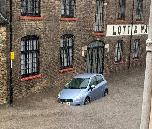
Flooding in this area was worsened for some properties by bow waves from vehicles passing through the flood water.
The redevelopment of the White Hart Inn site, now White Hart Mews, may also have exacerbated the issue. Surface water running down High East Street used to accumulate outside the pub, gradually draining into the Mill Stream. This is now not possible due to the redevelopment, causing a build up of water on the junction outside Gateway House.
The condition of highway drainage system in the vicinity of Gateway House was also questionable.
Figure 4 below shows the flow paths for this area, highlighting the accumulation of water on Fordington High Street.
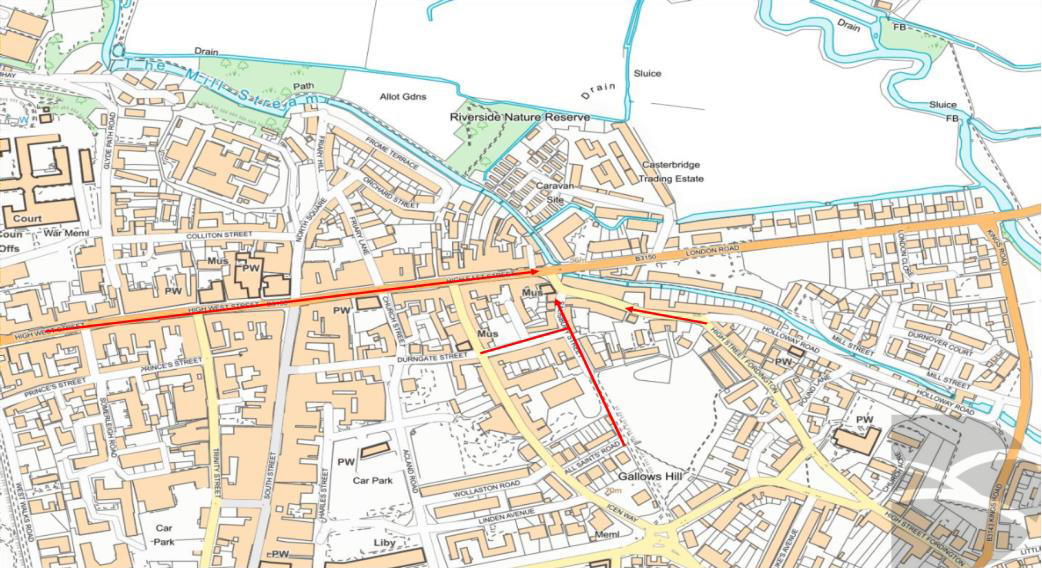
DC Highways have reviewed and cleared their highway drainage infrastructure in affected areas and identified where further works are required.
Kings Road/Evie Place
This vulnerable location has a history of flooding. It is a low point in Dorchester, with overland flows coming from Allington Road, Kings Road and High Street Fordington. These steep flow paths resulted in an overwhelming of the public surface water sewer system, leading to accumulation of water at Evie Place.
A visit to site has been held with Wessex Water, who have since run a CCTV survey of their surface water sewer system. It was shown to be blocked, and Wessex Water have cleared their system of siltation. To prevent future blockages, they have added this drainage system to their regular maintenance schedule.
Olga Road
Olga Road is another low point in Dorchester, with overland flow paths converging between numbers 47-57 (Southern side) and 32-36 (Northern side).
These flow paths come from Edward Road, Alexandra Road, Louise Road, Cambridge Road and Maud Road (Figure 5).
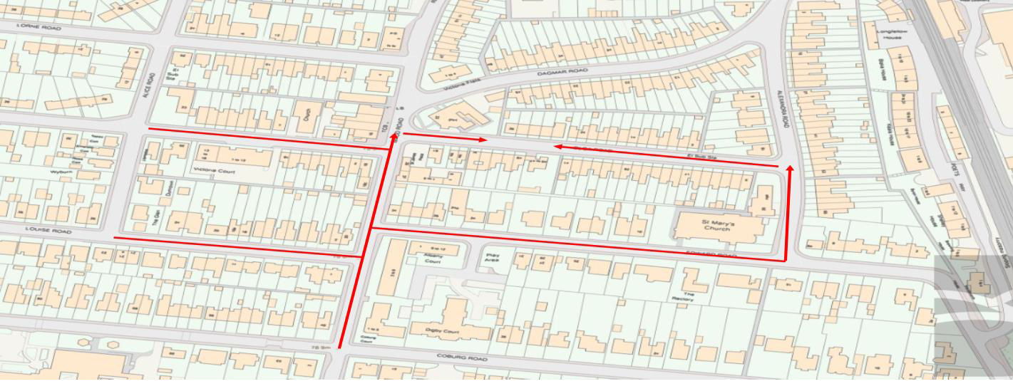
The main cause of this was again, the extremely heavy rainfall which lead to the Highway drains becoming overwhelmed. The system was unable to deal with the flow from the surface water run-off.
There is a high chance that even when cleared, the highway drainage may not cope with the flow of water. However, it is recommended that the gullies and drains are checked and maintained regularly to enable the free flow.
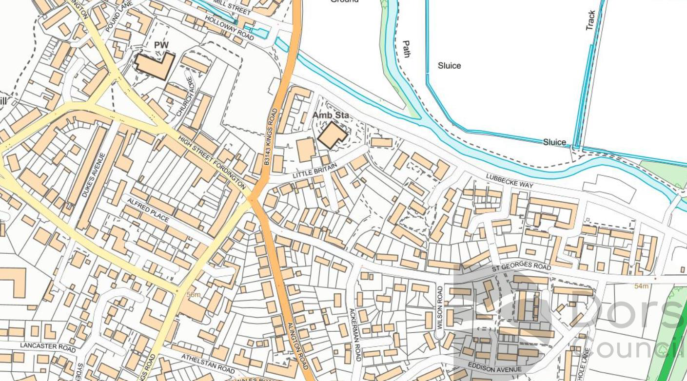
Weatherbury Way
Weatherbury Way sits at another low point in Dorchester, with Manor Park School sitting to the North East and a large embankment separating the area from the A35 to the South East.
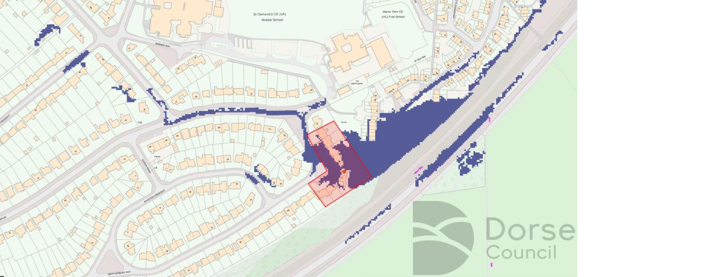
The flow path runs down from the roads surrounding Weatherbury Way, accumulating on the green outside 112. The affected area is shown by the red shaded area shown in Figure 6.
It is recommended that Manor Park School ensure all drainage on site is clear and a maintenance schedule is adhered to. Highways have liaised with them to ensure proper maintenance is taken. Highways will also ensure all gullies are cleared regularly.